
Alpi Marittime
In the border region with Liguria, the name Alpi Marittime is easily confused with the Alpi Liguri. The distinction matters when finding your way around: the two mountain areas border each other, but differ in location, landscape and protected areas. So if you want to visit mountain villages in Liguria, first identify the specific valley and the relevant park.
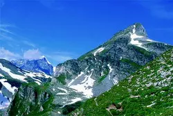 Einach schön: Die ligurischen Alpen.
Alpi Marittime: key facts
- The Aree Protette Alpi Marittime places the Alpi Marittime west of the Colle di Tenda.
- To the east lie the limestone Alpi Liguri, which include the Marguareis massif.
- The Parco Alpi Liguri is in the province of Imperia, between the French border and southern Piedmont.
- Monte Saccarello reaches around 2,200 metres and is Liguria’s highest peak.
- When planning a trip, the valley, starting point and current access conditions are key.
Two neighbouring mountain ranges, not a single park
The official geological classification by the Aree Protette Alpi Marittime places the boundary at Colle di Tenda: the Alpi Marittime lie to the west and the Alpi Liguri to the east. The western mountains are characterised by crystalline rock, while the Alpi Liguri are defined by limestone and karst formations. Under this classification, the Marguareis massif belongs to the Alpi Liguri. The shared name of the protected-area authority does not mean that all the places mentioned are in the same mountain region.
The Parco Alpi Liguri is also relevant if you are travelling to Liguria. It is located in the province of Imperia and covers areas between the French border and southern Piedmont. Do not confuse it with the Parco Naturale Alpi Marittime in Piedmont. The protected areas border mountain landscapes, but are in different regions and have their own visitor information.
Three valleys in the Parco Alpi Liguri
The park describes three valleys, each with its own character. The area around the Torrente Nervia includes Rocchetta Nervina and Pigna, among other places. Closer to the coast, it combines cultivated slopes with forests at higher elevations. Triora and Molini di Triora are in the Alta Valle Argentina. The valley climbs steeply and leads to settlements on ridges and rocky outcrops. The Alta Valle Arroscia, with villages such as Rezzo, Mendatica and Cosio d’Arroscia, is more mountainous, with extensive woodland and pastureland.
These differences in location can help you choose where to go: if you are planning a short detour from the Riviera, you could choose a valley closer to the coast; for villages higher in the mountains, allow more driving time and plan your day carefully. Roads follow the contours of the land, and do not connect every village by a direct route. So check the access route to your starting point in advance, along with the information provided by the relevant nature park.
Mountain hikes with the right preparation
The landscape ranges from cultivated valleys to alpine elevations. Choose a route based on elevation gain, distance, weather and your own experience. A hiking trail that looks close on a map may involve a longer approach because of the changes in elevation and winding roads. Bring enough water and suitable clothing, and check trail markings and any closures. Do not assume that mountain huts, public transport or seasonal services will be operating; check for the specific day instead.
A gentler trip can also combine nature and culture: visit a valley’s main village, eat at a local establishment that is open, or pair a day in the mountains with a coastal town. The historic landscapes and local cuisine vary from valley to valley. If you are planning a longer stay, compare the landscapes of Liguria with the Riviera dei Fiori to put together a balance of seaside and inland destinations that suits you.
How to identify place names and map locations
When looking for a route, always check whether the map refers to the Alpi Marittime, the Alpi Liguri or the protected area in the narrower sense. A destination name alone may lead you to a different starting point than you expect. Record the municipality, valley, car park and trailhead separately, and compare these details with the park operator’s latest information. This will help you avoid confusing peaks, valleys and protected-area boundaries, and choose an outing that fits the time you have available.
Photo: www.planetmountain.com
