
Monte Saccarello: circular route from Realdo
Key facts about the circular route from Realdo
- Start and finish: Realdo, at an elevation of 1,007 metres.
- Circular route via Chiesa Sant’Antonio, Passo di Collardente, Monte Saccarello, Rifugio La Terza, Passo di Garlenda and Verdeggia.
- Monte Saccarello reaches 2,200 metres and is Liguria’s highest peak.
- The park gives the circular route a duration of 7 hours 30 minutes, with 1,203 metres of ascent and descent each.
- The difficulty is rated E; the park describes the hike as long and challenging.
A long circular route over Liguria’s highest peak
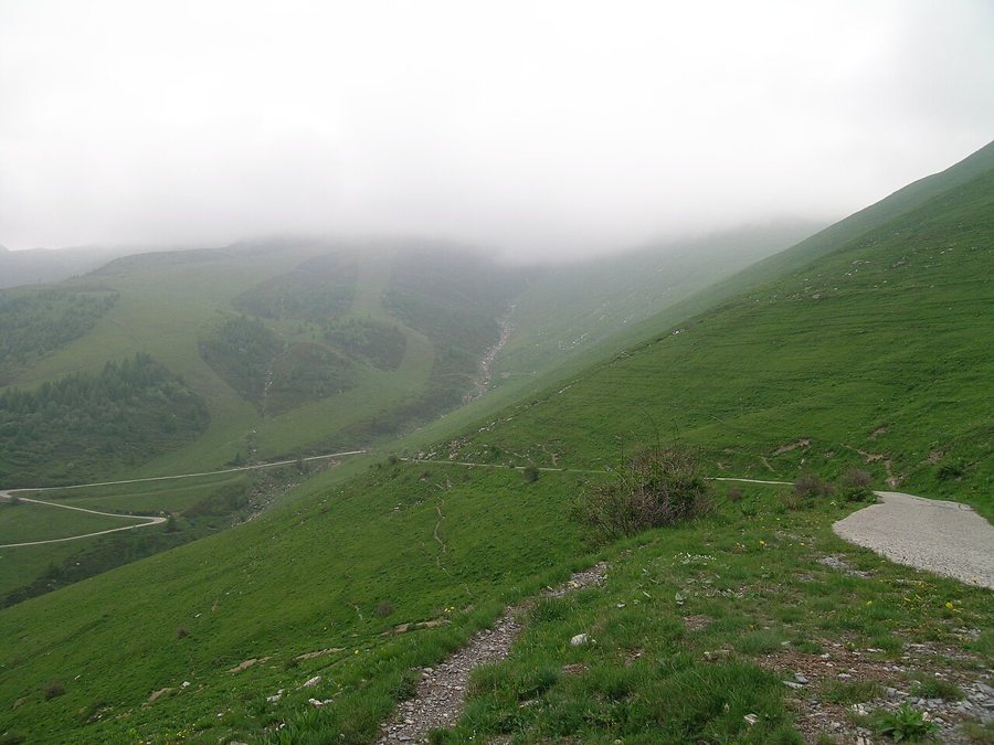
The circular hike begins on the edge of Realdo and climbs along old mule tracks and trails to the ridge. Its highest point is Monte Saccarello, at 2,200 metres. From there, the loop passes Rifugio La Terza and Passo di Garlenda to Verdeggia, then returns to Realdo. The route therefore links two mountain villages, wooded ascents, open high-altitude trails and a long descent back into the valley.
The time required is an important factor when choosing this hike: the nature park gives a walking time of 7 hours 30 minutes and around 1,200 metres of ascent and descent. Breaks and travel time are additional. Its official E rating and description as a long, challenging mountain hike make this a full-day outing. It is suited to sure-footed hikers with stamina and experience on steep mountain trails. A late start leaves little margin for returning in daylight.
The route from Realdo to the summit
Realdo lies at 1,007 metres. From the car park on the edge of the village, a mule track first leads to the church of Sant’Antonio at 1,191 metres. Beyond the church, the route climbs more steeply through coniferous forest. At Passo di Collardente, at 1,599 metres, the trail opens onto the western ridge of the Saccarello. Larches and rhododendrons characterise this higher section.
The trail climbs steep sections to the summit. The ridge trail beyond passes the Redentore statue and the privately run Rifugio La Terza at 2,051 metres. The park lists Passo di Garlenda, at 2,013 metres, as the next notable point.
Descent via Case Vesignana and Verdeggia
From Passo di Garlenda, a steep descent with tight switchbacks leads to a gravel road. The route crosses the slopes below Rocca Barbone to reach Case Vesignana at 1,519 metres. From there, trails and mule tracks alternate until the first houses of Verdeggia, at 1,100 metres. A forest track running parallel to the provincial road leads back to Realdo. This makes the summit hike a true circular route, ending at the starting point rather than requiring a second form of transport at the end.
Getting there and a suitable place to stay
The park’s route description gives directions from Arma di Taggia via the SP548 to Molini di Triora, then via the SP52 to Triora and finally via the SP81 to Realdo. It lists no direct scheduled bus service to Realdo, so the starting point is intended to be reached by private vehicle. For an overnight stay in the valley, the accommodation options in Molini di Triora can be considered as a base near the access route. The accommodation guide to Liguria offers other options for a longer trip with several stops.
When driving in Liguria, the winding access roads to the mountain villages add to travel time. A longer active holiday can combine days in the high mountains with sports on the coast. Realdo and Saccarello lie within the Ligurian Alps Nature Park.
Season, elevation and mountain weather
The route climbs to 2,200 metres and follows an exposed ridge. A snow-free period with stable mountain weather is the right time for this long hike. Snow, ice, fog and thunderstorms increase the challenges on exposed high-altitude sections; in winter, alpine experience and suitable winter equipment are essential. Anyone planning this hike should take the latest mountain weather forecast and snow conditions around the summit into account when choosing a date.
FAQs about the Saccarello circular route
Is the circular hike suitable for beginners?
The nature park describes it as long and challenging: 7 hours 30 minutes of walking, with 1,203 metres of ascent and descent each. It is suited to fit, sure-footed hikers with experience on mountain trails.
How do you get to the starting point in Realdo?
The park’s route description gives driving directions via Molini di Triora and Triora and lists no direct scheduled bus service to Realdo. The hike ends back at its starting point in the village.
