
Sentiero del Pellegrino: Noli–Varigotti
The Sentiero del Pellegrino connects Varigotti and Noli along a scenic high-level trail above the sea. The route is worth choosing if you’re looking for a longer hike with cultural and scenic highlights rather than a stroll along the beach. The 8-kilometre one-way distance and 370 metres of elevation gain refer to the guided Finalehiking version; it is rated as a moderately difficult hike and includes detours to viewpoints. For an independent day trip, plan the route as a one-way walk: TPL Linea connects Noli and Varigotti on route 40/. For more ways to combine hiking with a relaxing stay on the Riviera, see the regional overview of active holidays in Liguria.
From Varigotti via San Lorenzo to Capo Noli
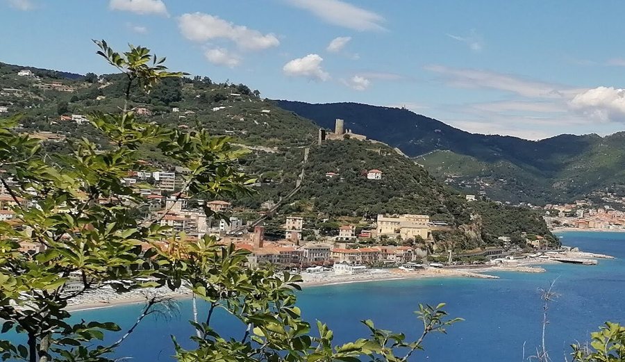
The trail starts on Strada Vecchia in Varigotti. First, climb through olive groves and Mediterranean scrub to the Chiesetta di San Lorenzo, where views open up over Baia dei Saraceni. Further along, you’ll pass the Mausoleo Cerisola and Torre delle Streghe; the detour to Grotta dei Falsari is on the Noli side of the trail and descends steeply into the cliff face. The cave is a side trip, not a through-route. After rejoining the main trail, the path crosses Capo Noli and leads into the town centre. The walk thus combines coastal views with religious buildings and traces of the past.
According to the Comune hiking map, the approach to Semaforo from the Noli side passes via the Chiesetta di Santa Margherita and takes about an hour, excluding breaks and a visit to the cave; the climb is around 270 metres. Visiting Grotta dei Falsari adds about 100 metres of elevation gain on a steep detour. These figures describe the section from the Noli side and make clear that reaching the cave involves a strenuous climb back up. There are no drinking-water fountains along the route, so bring plenty of water and wear sturdy hiking shoes.
Return journey and planning your day
For this one-way hike, the bus is a convenient way to get back: TPL Linea’s current winter timetable lists route 40/ in both directions between Noli and Varigotti; it also connects the coastal towns with Finale Ligure and Savona. This means you can board at whichever town you finish in, rather than retracing the coastal section on foot. The overview of train connections is useful when travelling via Finale Ligure Marina or Savona.
The area can be reached by car via the coastal towns; information on getting there and parking can help you choose between the starting point and the destination. Since the walk starts and ends in different places, staying in Finale Ligure or in a town near a railway station is practical if you plan to combine the day trip with other coastal trails. The guide to planning your accommodation in Liguria is a good place to start. In case of forecast severe weather, this exposed coastal trail is not a suitable alternative route; the weather warnings for Liguria explain the regional warning levels. The walk ends on arrival in Noli, a historic town with its own lanes and harbour to explore—not back at the starting point.
