
Maremonti cycling route between Levanto, Bonassola and Framura
The Maremonti cycling and walking route connects Levanto, Bonassola and Framura along the coast. It follows the former railway line, now closed and converted into a seaside path. The route is around five to six kilometres each way. Its elevation stays close to sea level, rising only a few metres above the coast. This coastal stretch is part of cycling routes in Liguria and can be explored on foot or by bike.
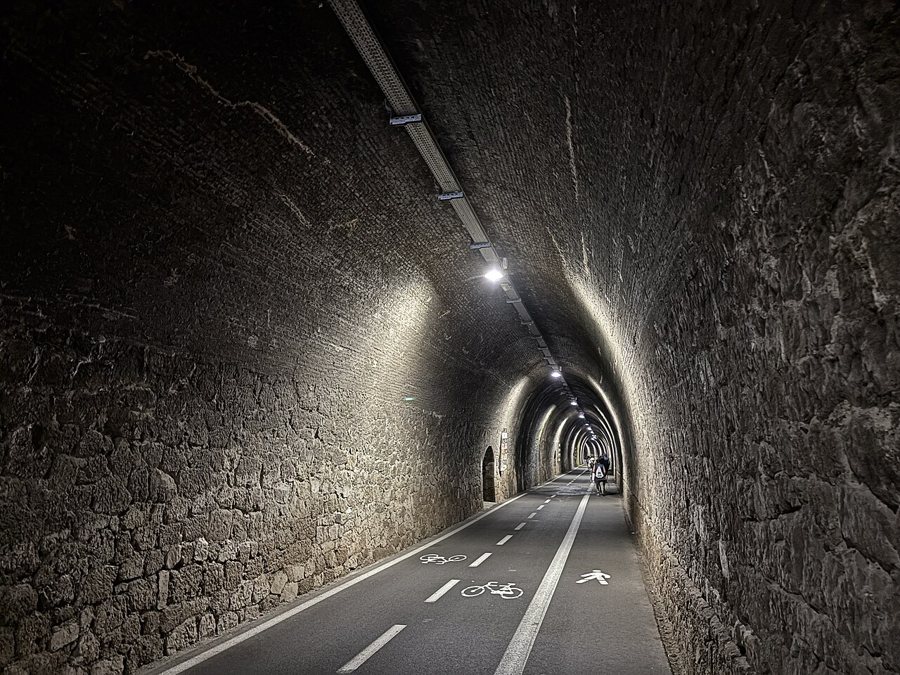
Surface, tunnels and shared use
The path is paved and mostly level. Markings separate the two cycling directions from the pedestrian lane; follow this layout in the tunnels and adjust your pace to other path users. The former railway tunnels are lit. The converted railway line connects the three towns and provides access to small coastal coves along the way. This is what sets the Maremonti apart from a road along the coast: you stay on a dedicated shared-use path for cyclists and pedestrians, passing through several sections cut into the rock.
From Levanto via Bonassola to Framura
Start on Levanto’s seafront promenade. Follow the Maremonti towards Bonassola, where you can take a break from the route to stroll along the crescent-shaped beach and through the pedestrian area. The bay is mostly pebbly, and the seabed deepens quickly. The former railway line then continues to Framura. The town comprises five separate hamlets that stretch uphill from the coast. You can cover the entire route as a linear outing or combine individual sections with time at the beach and in the towns. Bonassola makes a natural turning point for a shorter coastal loop. The pages on Levanto, Bonassola and Framura can help you choose suitable stops along the way.
The return journey and choosing a base
If you walk the entire route there and back, allow for roughly the same distance on the return leg, bringing the total to around ten to twelve kilometres. For a shorter outing, choose one of the towns as your turning point; you can also end a walk at any of the three railway stations. The route stays close to all three stations. Regional trains run along the same stretch of coast; the guide to train connections in Liguria explains how to use the railway to get there and back. Levanto makes a good base, with its beach and historic centre, while in Bonassola you can stay right by the bay and in Framura among its scattered hamlets. The accommodation guide for Liguria can help you choose according to your starting point and preferred day-trip distance.
The route is therefore suitable both for a shared coastal walk and for a cycling trip with stops along the way. Its key planning considerations are the distance, the paved former railway line and the marked separation of pedestrian and bicycle traffic. If you stop at one of the small coves along the way, you can continue along the same path later or switch to the train at Levanto, Bonassola or Framura.
