
Badalucco: Bridges, Churches and Painted Lanes
Location and getting there
Badalucco lies at an altitude of about 179 metres in the middle Argentina Valley, where the river makes a broad loop around the village centre. Unlike Triora and Molini, it is a valley village farther downstream and makes a good starting point for exploring the Argentina area. The drive from Taggia follows the road up the valley; Taggia-Arma is a convenient coastal base, as rail and road connections meet there. If you want to combine Badalucco with Triora, plan the two villages as separate stages at different elevations along the same valley drive, rather than treating the route as a short trip between towns.
Bridges, lanes and churches
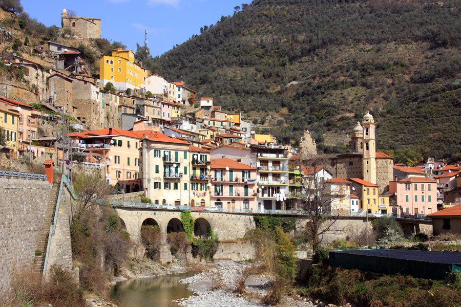
Start at one of the bridges. The Ponte di Santa Lucia was built between 1551 and 1606 and follows an older route dating back to Roman times; farther into the village is the Ponte della Madonna degli Angeli. Together, these crossings show how the river shapes the layout of the village. Then explore the lanes in the centre: Badalucco is known as the “Paese Dipinto” (painted village), with ceramics and murals woven into everyday life on façades and in passageways. The walk is therefore a series of small discoveries rather than a route leading to a single monument.
The parish church of Santa Maria Assunta e San Giorgio is well worth visiting in the central church area. The Baroque building was constructed between 1683 and 1691; inside are a wooden sculpture by Anton Maria Maragliano, an ensemble of angels, and paintings from the 17th and 18th centuries. From the valley floor, you can then climb to the church of San Niccolò, which stands on the site of the former castle. From the top, there are views over the village and the river bend. This climb makes a scenic finish to the circuit, but takes more time and effort than exploring the level village centre.
View of the river from the hillside
The two bridges provide a clear orientation for the walk: between the crossings, you pass through the historic centre, while the river bend shapes the routes to the opposite hillsides. Olive terraces cover those slopes; at higher elevations, they give way to Mediterranean scrub and woodland. If you only want to visit the village centre, you can combine the flat riverside and lane circuit with a stop at the parish church. To reach the viewpoint at San Niccolò, add an uphill path; the view from there makes the location of the former castle hill easy to understand.
Badalucco works well as a half-day visit in its own right or as a stop on the way to Molini and Triora. The river crossings, church art and street art define the visit. The Imperia Province overview places the village in the eastern part of the province; the page on the Riviera dei Fiori adds context about the coastal landscape. For the drive along the mountain road, see Driving in Liguria; for travel to Taggia, consult the overview of train connections. Find a base for your trip through accommodation in Liguria. Badalucco lies in a region of olive groves; background on the Taggiasca olive and Liguria’s wines adds to the picture of its cultural landscape.

